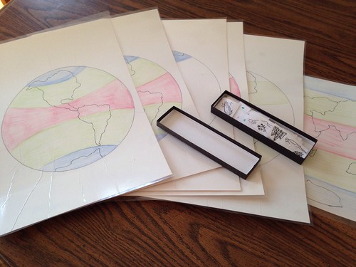
6 Maps. My album actually calls for 7, but I chose to leave out the control chart for the climate zone pictures since they also have the colored dot to use as a control.
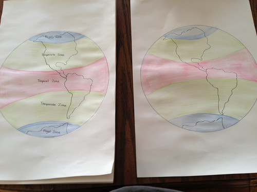
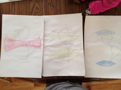
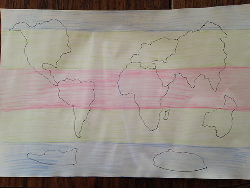
The maps are easy to make using the world puzzle map. I used a fine line permanent marker to trace the continents and watercolor pencils to fill in the regions. The pictures above are in the drying stage prior to laminating!
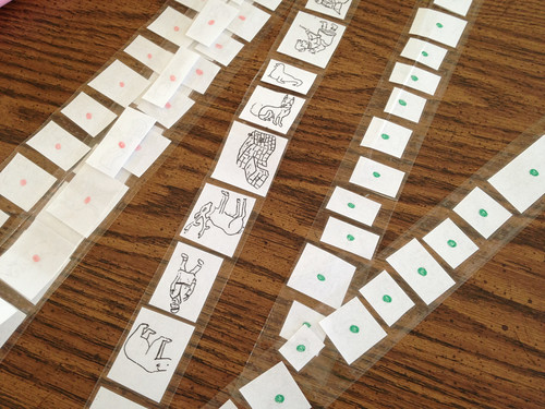
Picture Cards for the 3 Climate Zones (Frigid, Temperate, & Tropical), laminated and marked on back with a colored dot for control. I used somewhat abstract line drawings that were in my album, you could also use realistic images or drawings. I left mine black and white, but they could also be colored in.
My early childhood album includes this presentation in the mapping sequence right before continent picture studies. Climate Zones are also included in elementary geography through the geography charts (specifically the topic of Movements of the Earth and Their Consequences: Charts 18-29). These charts cover a more in depth look at why the earth is hotter in certain places, at certain times of the day, and during certain seasons. While not the same charts, the early childhood maps could be adapted (especially for us space starved homeschoolers!).
Basic Presentation
Present the labeled map with all three zones colored.
Discuss the characteristics of the individual zones with the individually colored maps
Display the picture cards in the proper zone of the large unlabeled map
Make observations about common traits of the zones (look at the clothing the people were, the types of things that thrive there, etc)
Extensions, Follow up, and other uses
Mix up pictures and sort without using control dots
Use magazine pictures to create students own map of one characteristic (people, houses, animals, vegetation)
Tie to Fundamental Needs of People presentations
Thanks for sharing this, and with all the pictures! It is really interesting to see it because it is different from my albums. Seeing it done a different way makes me understand my version better and will help me be more flexible when we do ours. I'll be sure to post about ours when we get to it so you can see how ours looks.
I think the main difference is that instead of making so many charts I make the master chart and a mute chart. So, the child can create all of the other charts you did by choosing only some of the pieces to put on the mute chart.
That whole sorting images by zone activity is new to me. We are doing Waseca biome work, so I don't think I want to create a whole other animal/people sort BUT if we want to I we could use a selection of the cards and do a similar sort. I LOVE that you are sharing elementary Montessori work!
I think what really struck me about this particular set is that they were actually in my early childhood albums which I hadn't looked at in forever. (They aren't actually mine, a friend lent them to me and it somehow became a perm. lend as she didn't want them any longer.
I know exactly what charts you are talking about because as I am looking ahead to make the dynamic geography charts I actual found Tim had already made a small hand chart with the moveable pieces. That chart has more discussion though with different colors for different tilts of the earth's axis based on seasons. I like that one, but we haven't actually used it yet since we aren't that far. These climate charts alone fit in nicely with early culture study since there is so much of a culture that is dictated by climate.
That makes sense.
Speaking of Waseca, I was laminating the elementary "Introduction to Biomes" work and found little 3×3 cards of all the charts you made in there. LOL. Looks like that connection will be easier to make than I even thought. I should read that manual more closely.